NB! · Archive · Faith · Geography · Maps

NB! · Archive · Faith · Geography · Maps
The East · Geography · Maps
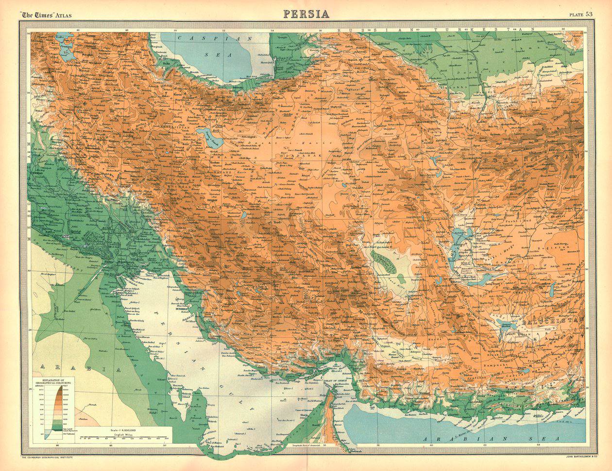
A Map of Persia from 1922, a Diagram of the Border with the USSR and a Map of Present-Day Iran. The shared border between Iran and the USSR: 2,500 km of land border, Azerbaijani-Iranian, Armenian-Iranian and Turkmen-Iranian, together with the maritime border on the Caspian
Geography · Monarchies · Society
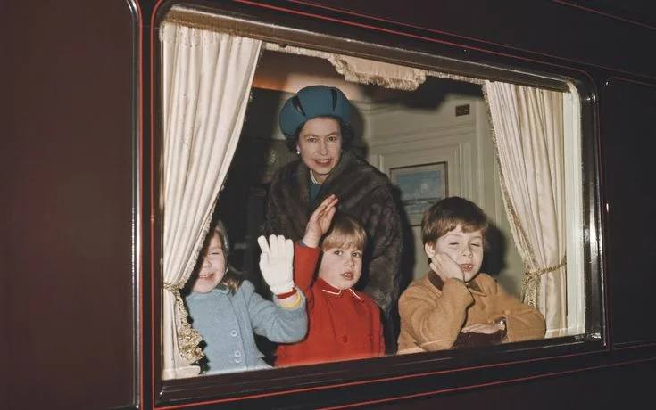
After 125 years, the Royal Train is being decommissioned as part of the need to cut costs. Not that the British royal family is gradually bidding farewell to its old spendthrift habits; it is simply that the train matters less to Charles than it did to Elizabeth II and Prince
NB! · Geography · Maps · Books
Geography · Observations · Society
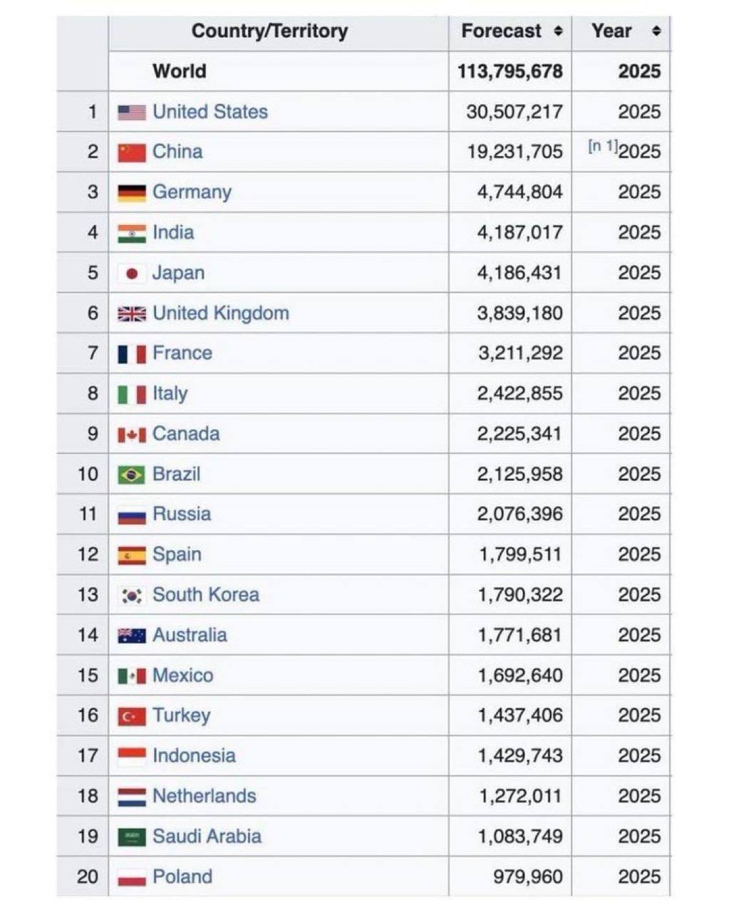
From the news of the list of the twenty largest economies in the world: Spain is still on it, China has still not overtaken the USA, though for years we have been promised that this is about to happen (the gap, incidentally, is huge), but the gap between second and
Faith · Geography · Society
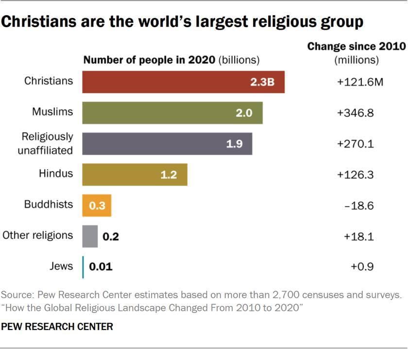
Between 2010 and 2020, the world's religious landscape changed considerably. Here are some statistics from the latest report by the Pew Research Center: Christianity remains the largest religion in the world: over the decade the number of Christians grew by 122 million, reaching 2.3 billion by 2020.
Geography · Observations
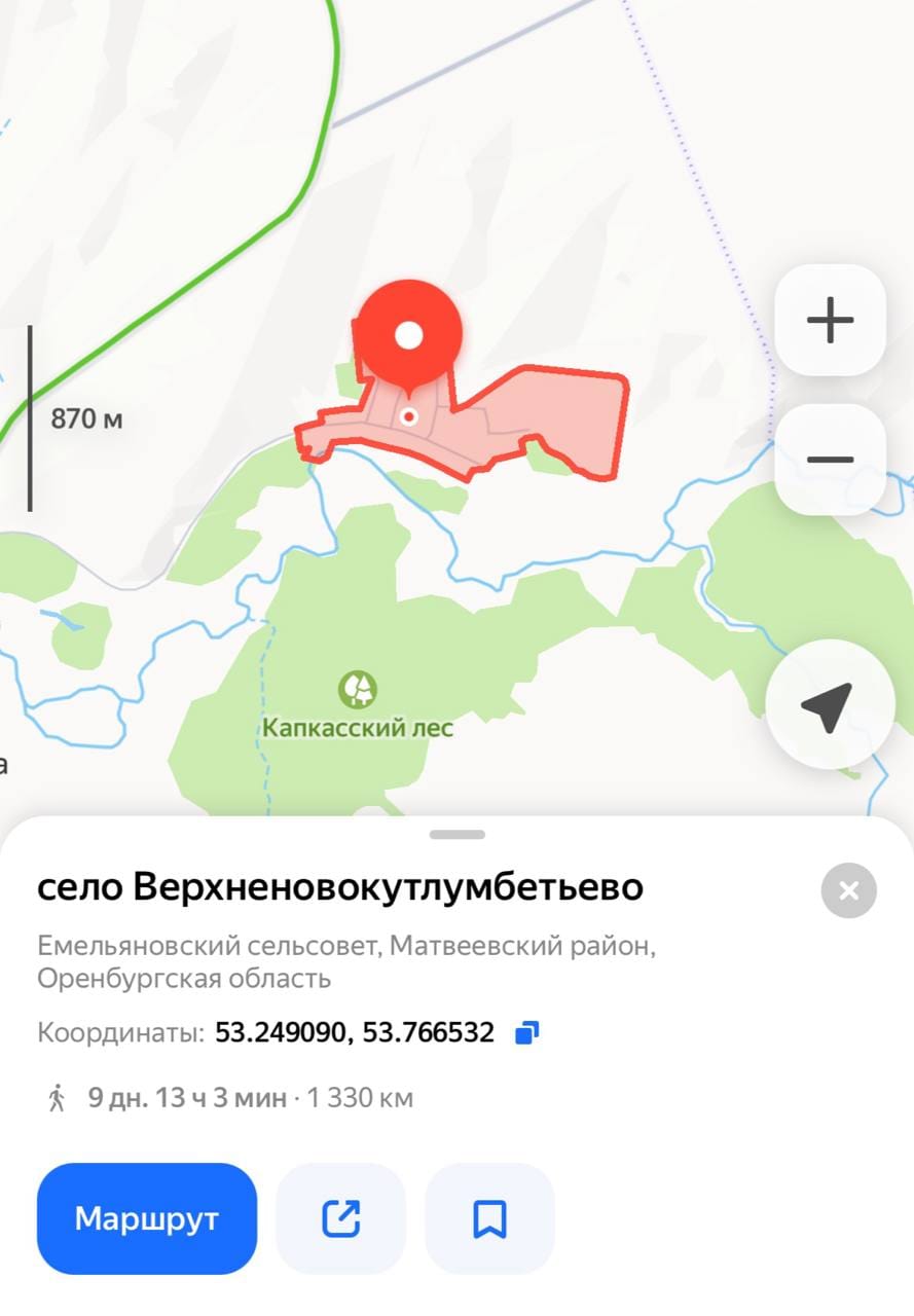
The longest place name in Russia without spaces or hyphens is Verkhnenovokutlumbetyevo (23 letters). It is a village in the Matveyevsky District of Orenburg Oblast. As for settlements whose names are written with a hyphen, the longest name in Russia belongs to the village of Kremenchug-Konstantinovskoye in the Kabardino-
NB! · Geography · Maps
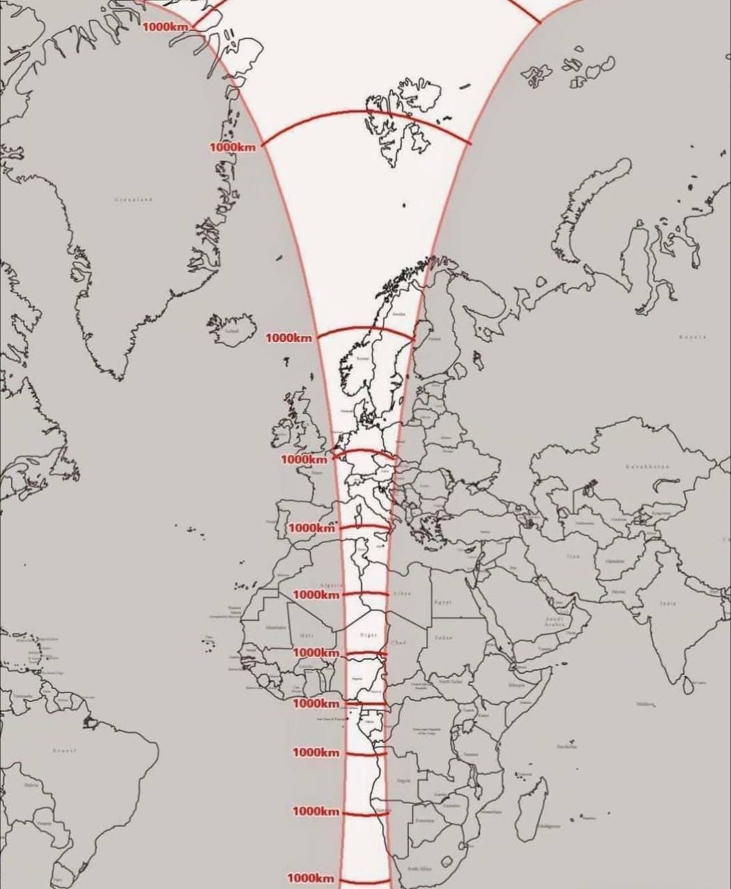
NB! · Geography · Maps · Science

Geography · Nature · Humour
The small New World monkey, the bald uakari, or western cacajao, is known in Brazil by a far simpler name: macaco inglês, that is, the English monkey. Popular rumour has very accurately noticed the outward resemblance of this inhabitant of the tropical forests of Amazonia to English colonists, especially after
Archaeology · The East · Geography
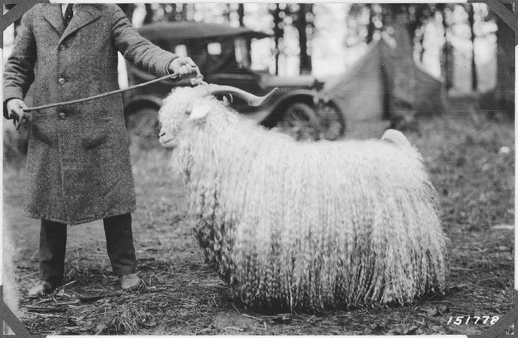
On the spread of international trade in antiquity: during excavations of the Etruscan city of Lattara in the south of France, fragments of woollen goods were found, dated to the 5th-6th centuries BC and made, quite definitely, from the wool still famous today, produced in Kashmir. Wool from the
The East · Geography · Maps
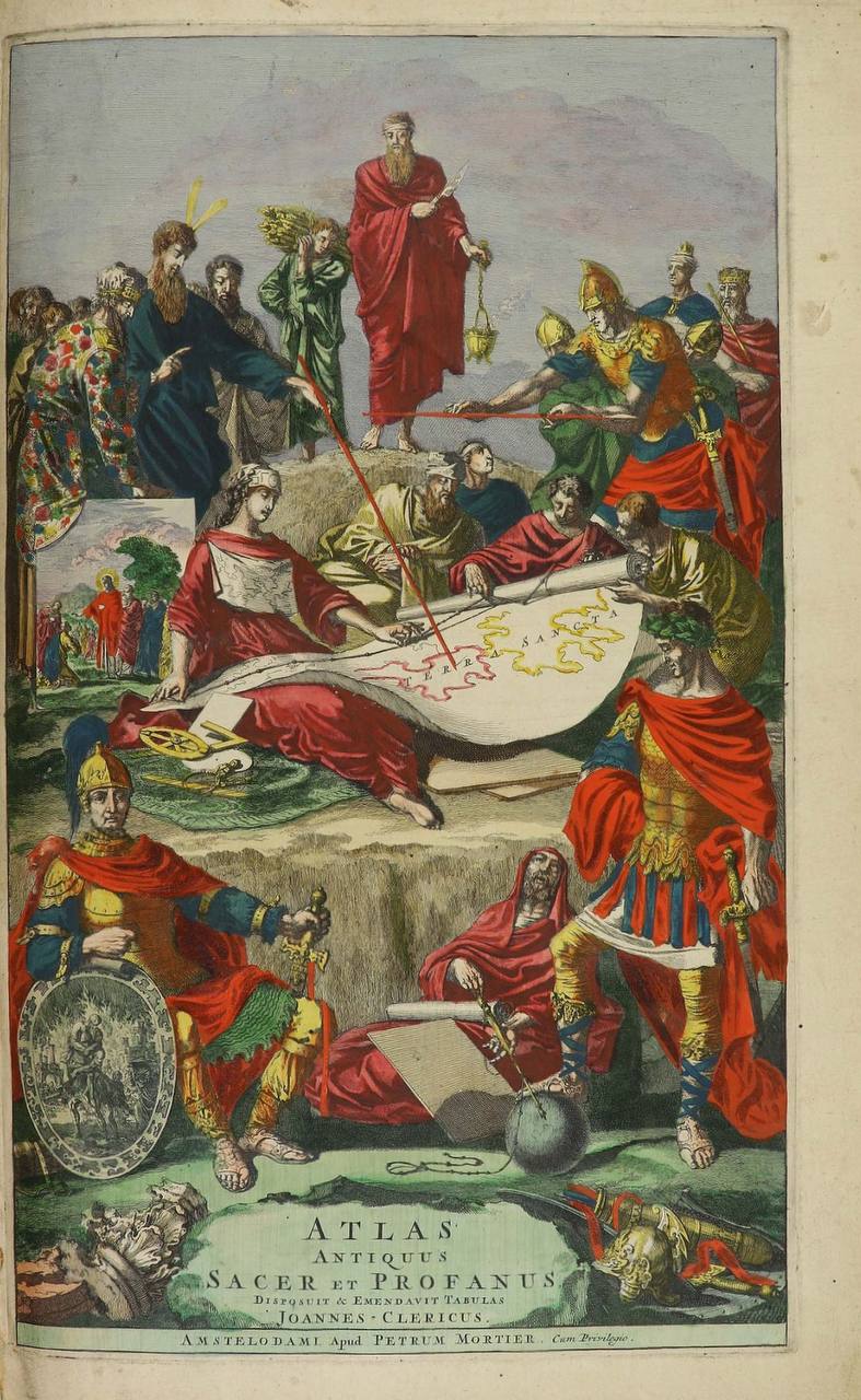
The Aral Sea appears on maps of Asia only at the very end of the seventeenth century. Indeed, many atlases of even later date, such as this atlas by Sanson, still show the Caspian Sea as if it were two seas in one: they mark the Syr Darya and the