European map of the early 17th century and the idea of a northern sea route to China
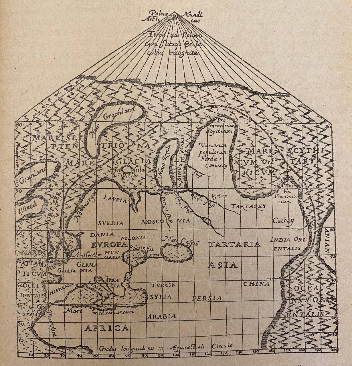
On a European map of the North-East Passage to China from the early seventeenth century, two names, CHINA and Cathay, stand side by side, separated by India Orientalis. The map illustrates not only the currency in Europe of Russian geographical names, but also the conviction, unshakeable at the time, that a sea route to China existed through the northern seas along the coasts of Russia