The Kapchagay Reservoir, created in 1969, on a map of Alexander the Great's empire
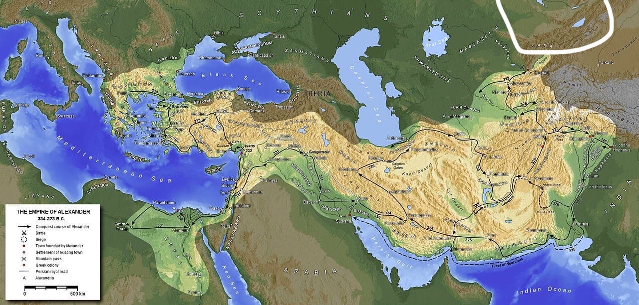
The map of Alexander the Great's empire caught my interest for its easternmost part. If one looks at the north-eastern frontier of Alexander's conquests, where they run up against the unsubdued Massagetae and Saka, one notices an amusing thing: the Central Asian lakes Issyk-Kul and Balkhash are quite clearly visible, and the small elongated body of water between them, along the course of the River Ili, is the Kapchagay Reservoir, an artificial lake that appeared in 1969. Not that this is some outstanding fact, but it does set one thinking, both about the influence of man on landscapes and about the principles of drawing historical maps: which relief should they record, that current at the time of the events the map describes, or that current for the modern viewer? Given the considerable antiquity of the empire in question, the appearance at its borders of a Soviet legacy in the form of a reservoir visible from space is, after all, rather ambiguous. And speaking of the water resources of Asia, the Aral Sea has plainly not been drawn here in its worst years