Map of the French provinces before their abolition and division into departments in 1789
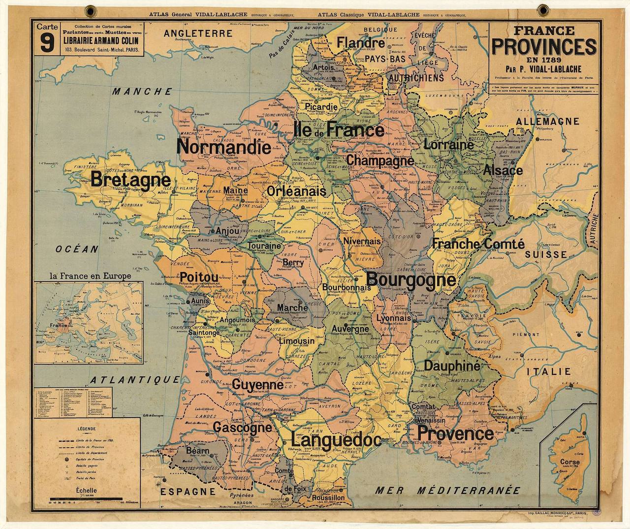
Before the Revolution, France was divided into provinces, many of which go back to medieval kingdoms and feudal territories. These provinces differed considerably in their laws, customs and administrative systems. During the Revolution they were replaced by departments, which were meant to ensure a more equitable distribution of territory and government, abolishing the old regional privileges and centralising power within a single national structure. Many of the provincial names still carry cultural and historical significance today; here are some of them:
Île-de-France, Berry, Orléanais, Normandy, Languedoc, Lyonnais, Champagne, Saintonge, Poitou, Guyenne, or Aquitaine and Gascony, Burgundy, Picardy, Anjou, Provence, Bourbonnais, La Marche, Brittany, Maine, Touraine, Limousin, Foix, Auvergne, Béarn, Alsace, Artois, Roussillon, Flanders and Hainaut, Franche-Comté, Lorraine, Corsica, Nivernais.