In 1618 an engraving with a view of Moscow appeared in the six-volume atlas of the cities of the world, Civitates Orbis Terrarum
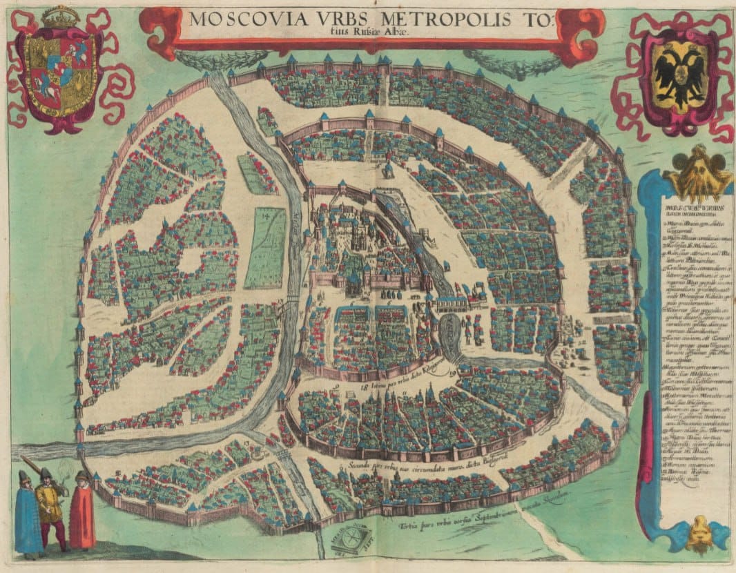
In 1618 an engraving with a view of Moscow appeared in the six-volume atlas of the cities of the world, Civitates Orbis Terrarum. The atlas was compiled by the Cologne priest Georg Braun, beginning in 1572, and this was already the second map of Moscow in the edition.
A second map of Moscow was needed for a concrete reason: in 1610 the boyar government invited the Polish prince Władysław to the Muscovite throne and admitted the Polish army into the Kremlin, where the garrison stayed until 1612, when it was driven out by the popular levy of Minin and Pozharsky. Braun decided that the old map might no longer reflect reality, and commissioned a new one.
The map clearly shows the Kremlin with its fortress walls and towers, rebuilt at the end of the fifteenth century, and the Assumption and Archangel cathedrals. Around the Kremlin lies wooden housing, with wide gaps between the houses.
In the caption to the map Braun remarks that Moscow is twice the size of Prague, but because of its size it has no clear boundary and is not truly fortified, having neither walls, nor moats, nor ramparts.
In the foreground, as on all the maps of the atlas, local inhabitants are depicted in traditional costume. Braun deliberately added human figures so that the maps could not be used by the Turks for military purposes: Islam forbids images of people, and in theory such a map became unacceptable to a Muslim commander