Analyst Arvind Kumar and Him Lal Gautam, Chief Surveyor of Nepal's Department of Survey, have published an article on the Himalayan flood of 26 August 2026
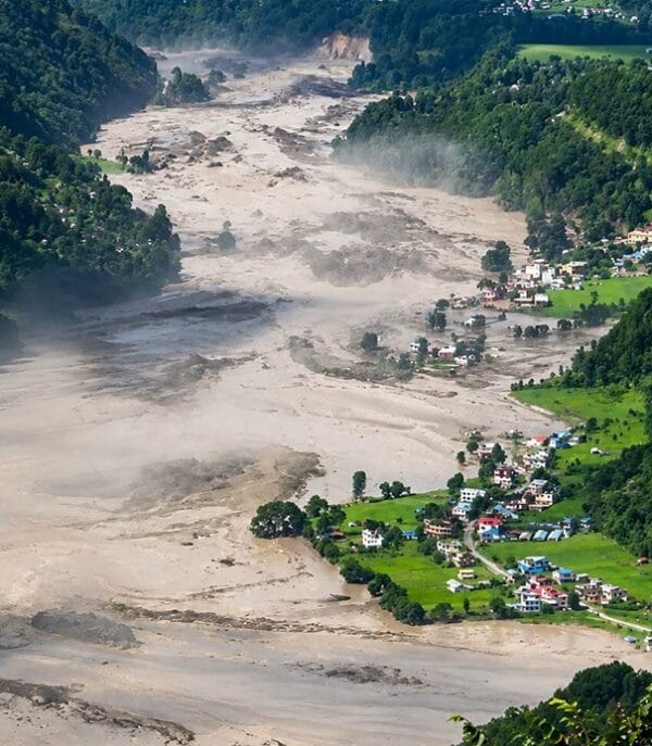
Analyst Arvind Kumar and Him Lal Gautam, Chief Surveyor of Nepal's Department of Survey, have published an article on the Himalayan flood of 26 August 2026. A rock-and-ice avalanche broke away that day from the northern slope of Langtang Lirung and turned into a debris flow, which swept down the Bhotekoshi and Trishuli rivers near the Chinese-Nepalese border.
The collapse released energy comparable to an earthquake of magnitude 5.2. The flood claimed the lives of more than 1,400 people and destroyed the Gyirong border crossing, the main route for people and goods from Nepal into China.
The authors write that the glaciers of the Hindu Kush and the Himalayas are losing, on average, about half a metre of ice thickness a year. According to the International Centre for Integrated Mountain Development in Kathmandu, the region's glaciers are melting roughly twice as fast as before 2000. Satellites show the area of glacial lakes, but not their depth, volume or the condition of their natural dams, while cloud and steep slopes hamper imaging.
In the authors' view, the services and the people living downstream need not maps and raw data, but concrete warnings: which lakes are dangerous, how high the flood will rise, and when the water will reach settlements, roads and hydropower stations. Countries must pass such data to their neighbours before the flood crosses the border. At present this exchange works only intermittently. The agreements of China and India on sharing data on the Brahmaputra and the Sutlej during the flood season have expired, and in 2025 India suspended the Indus Waters Treaty of 1960 with Pakistan. The authors propose that countries agree in advance on channels for transmitting warnings and hold joint exercises. As an example they cite the Mekong River Commission, which runs a regional centre for flood and drought forecasting