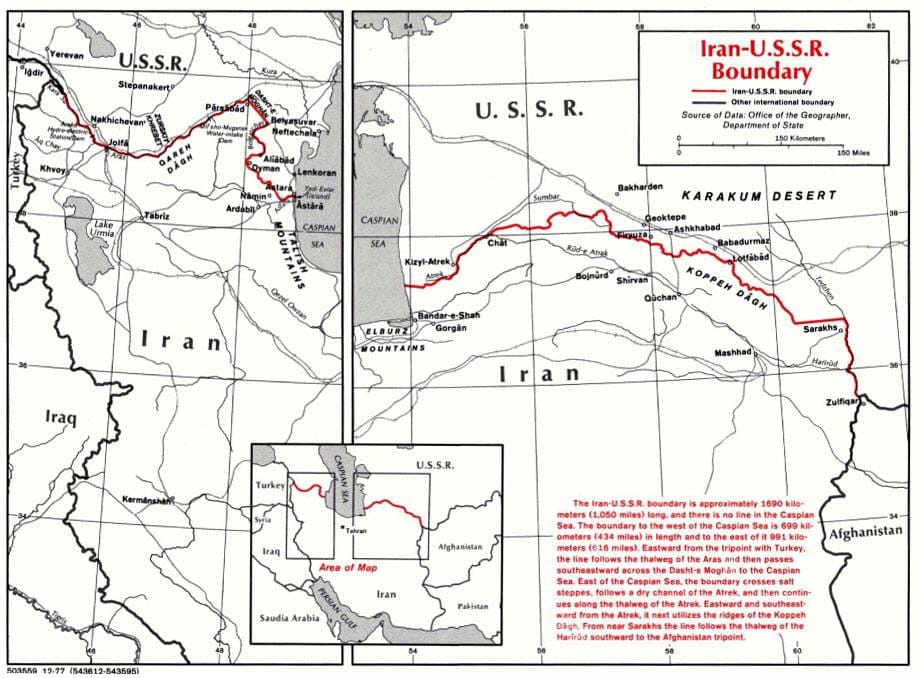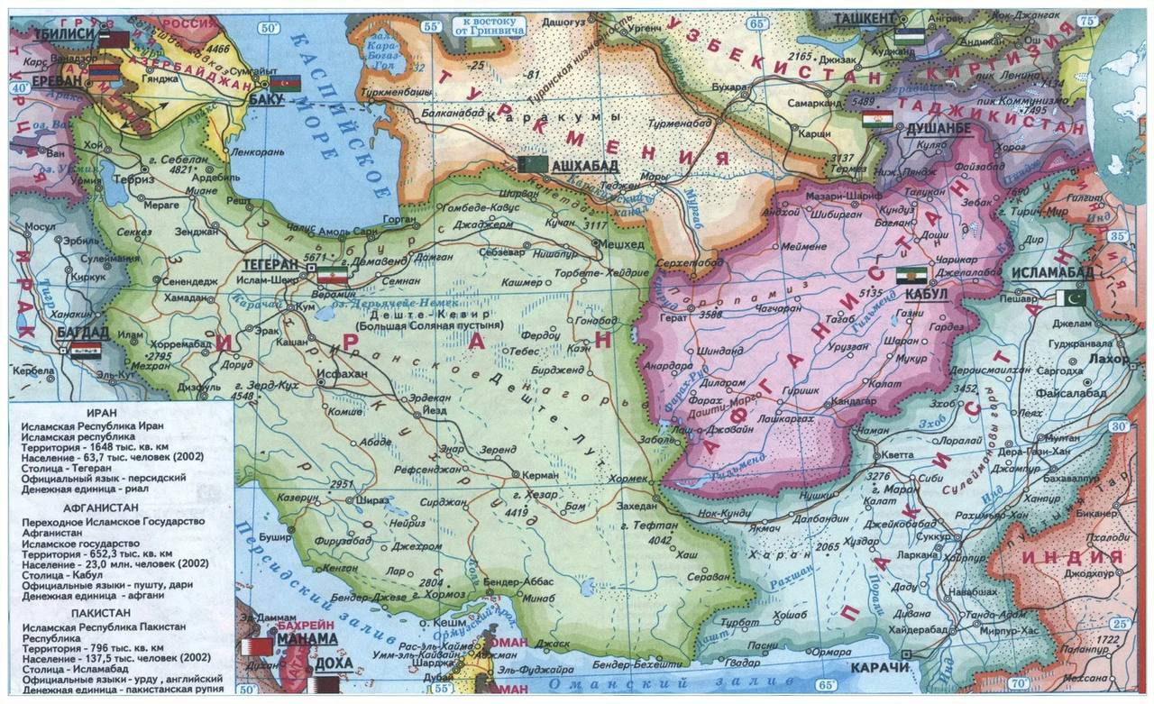
A Map of Persia from 1922, a Diagram of the Border with the USSR, and a Map of Present-Day Iran
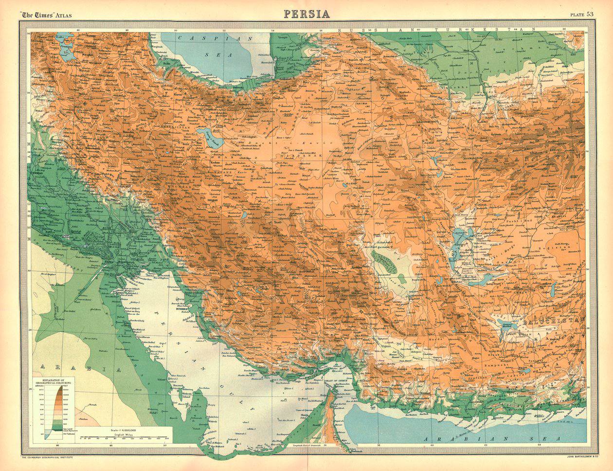
The shared border between Iran and the USSR ran to 2,500 km of Azerbaijani-Iranian, Armenian-Iranian and Turkmen-Iranian land frontier, together with a maritime boundary across the Caspian Sea